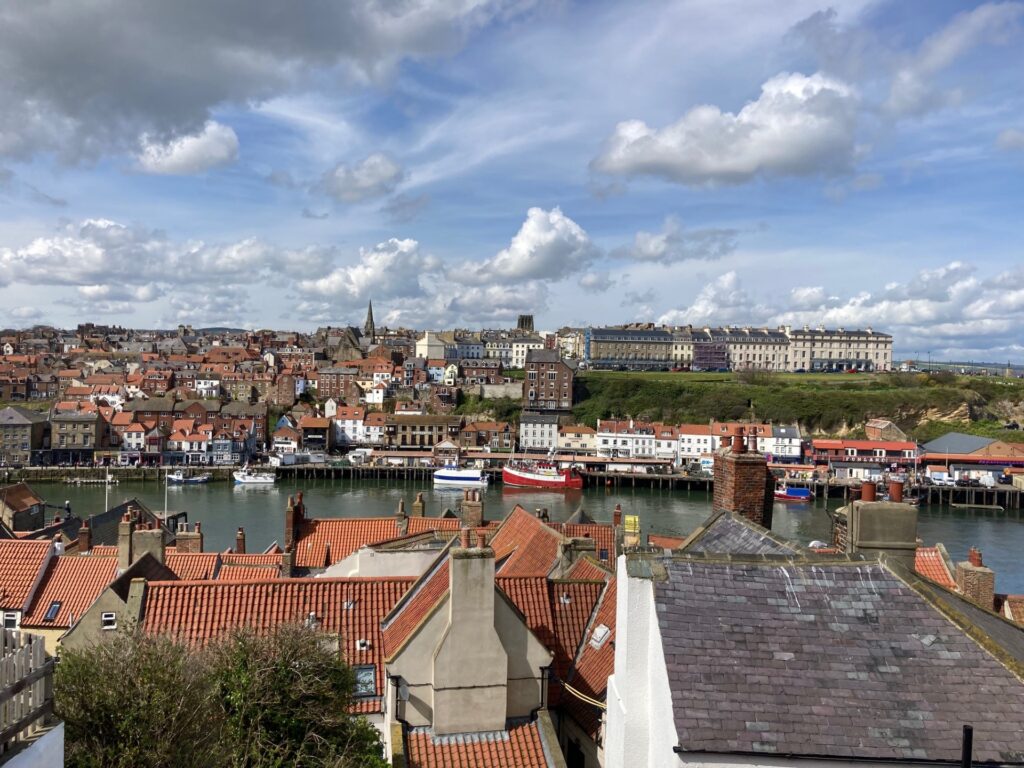
Our guide to Whitby harbour, piers and lighthouses.
Our beloved hometown of Whitby on the Yorkshire Coast surrounds the harbour, piers and the mighty River Esk.
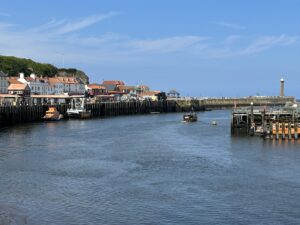
Fishing, whaling, shipbuilding … the list goes on as to maritime trades connected with Whitby.
Whitby Harbour today is still a busy port, offering a blend of shops, cafes, restaurants, fish and chip shops and more.
Did you know …?
Whitby was once the sixth largest port in Britain.
According to the North Yorkshire Council website, the harbour currently includes: the Fish Quay, the Lower Harbour, Tate Hill and Tate Hill Beach, St Ann’s, the Swing Bridge, New Quay Road and Dock End Basin.
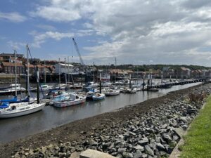
It also includes Endeavour Wharf, St Mike’s, Upper Harbour, Church Street Jetty, Church Street Pontoon, Eskside Wharf, along with slipways, single berth, a drying pontoon, the Harbour Master’s Office, the Marina Office, and of course the East and West Piers.
Archives and documents state the harbour covers 80 acres.
If you want to explore Whitby harbour, book you stay with us today!
Reaching Whitby
The River Esk is a tidal watercourse and back in the day before modern roads were built, it was said it was easier to reach Whitby by sea than by land.
This is because the hinterland of the town is host to what is now known as the North York Moors National Park.
It was an inhospitable and often dangerous terrain until a turnpike road opened in 1764.
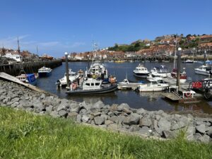
The First Harbour?
As the River Esk flows towards the sea, it carved its way through the landscape so a natural harbour was formed.
History research indicates merchants used this area in the 1300s to trade with the Abbey.
However, it is more than likely that activity of some sort took place many years before this.
Coal Trade
Our close connection with the more northern counties of England meant coal was traded along our Coast.
Evidence uncovered by historians indicate this trade goes back as far as 1392.
In the nineteenth century, colliers (the name given to coal-carrying ships) were produced in the town.
Coal was also mined further up north in Sunderland, Tyne and Wear and in other locations.
A precious cargo, coal often got shipped to London.
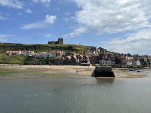
Tate Hill Beach is still known as Colliers’ Hope to many a Whitby resident.
This sandy and rocky part between the West and East Piers was a safe place for passing a passing ship in bad weather.
Alum Industry
Alum once had a value higher than gold, and is produced from processing shale.
It helped with the process of dying fabrics such as wool.
Local alum works include ones at Sandsend, Loftus, Boulby, Port Mulgrave, Saltwick, Ravenscar and Hawker.
Ship Building
Over the centuries, as larger ships were needed to carry cargoes, shipbuilding also flourished in Whitby.
These included timber ships during the age of sail.
Shipyards developed along the West Bank of the River Esk.
During the late 1700s, Whitby rivalled Newcastle as the second largest producer of merchant ships.
Whaling & The Arctic
The whaling industry of the 1700 and part of the 1800s ensured more wealth came to Whitby.
A dangerous occupation, men sailed for the Far North, usually Greenland, to chase and (unfortunately) kill whales, mainly for their blubber.
It is thought the last Greenland whaling voyage was made in 1837.
The Scoresby family, a father and son team, is forever connected with the industry and with the polar regions of the North.
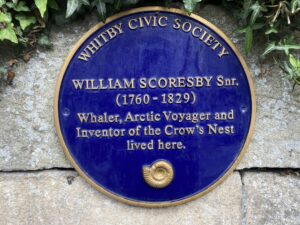
William Scoresby Junior studied the polar regions during his eventful life.
If you visit the Whalebone Arch during your visit to Whitby, then this marks the town’s connection with the whaling years.
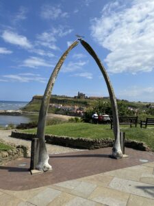
The current bones were replaced in 2003, formed by the bones of a Bowhead Whale, killed legally by Alaskan Inuits.
Captain Cook
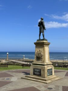
The famous explorer learned his trade in Whitby Harbour.
There is also his statue, next to the Whalebone Arch.
Visit the Captain Cook Museum, find out more here.
Other aspects of Whitby Harbour include the RNLI and local shipwrecks and places to eat within close range of the harbour.
The Piers
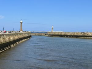
Whitby’s pincer-like piers and structures are unmistakable.
Known as the East and West Piers, their history is vast, yet it is thought that two piers in some form or other have been in place since before the 1500s.
In the reign of Charles I, two stone piers were built, then rebuilt in 1735.
Over the decades, the piers were extended and improved and they are now Grade II listed.
The piers are designed to protect the mouth of the harbour.
The Lighthouses
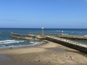
Lighthouses have a bit of a mystique connected with them!
You get remote lighthouses such as Bell Rock, contrasting with those like Whitby’s stone-built ones, which are more accessible yet no less fascinating.
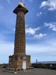
The West Pier lighthouse was constructed in 1831. The East Pier lighthouse was built in 1855.
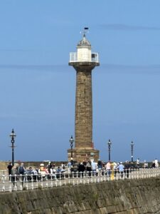
You can visit the West Pier one if you don’t mind heights!
Fishing and Crabbing
Crabbing is sometimes locally referred to as ‘doggering’, and is permitted in certain parts of the harbour.
For commercial fishing, lobsters, brown and velvet crabs are important to the local fishing industry.
Salmon are found in the River Esk from May to August.
Saltwater fish which are caught in the seas off Whitby include cod and haddock.
Pleasure Boats
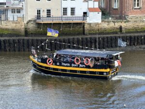
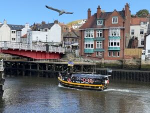
If you love life on the ocean wave, but can’t afford a yacht, then fear not!
Whitby Harbour is host to several pleasure boats and mini cruises.
The Swing Bridge
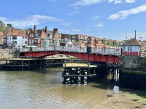
This landmark divides the upper and lower harbours and also joins the east and west side of Whitby.
In the 1620, it is thought a drawbridge was put in place with tolls being charged for passing ships.
The current swing bridge dates from around 1909.
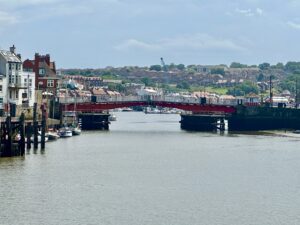
If you see the swing bridge open, it is quite a sight as crowds gather on either side of the River Esk.
The swing bridge will open two hours either side of a high tide.
Seeing the 75-foot road move slowly to let in shipping vessels is always impressive, no matter how many times you see it!
The North Sea and the Shipping Forecast
Once known as the German Ocean, Whitby faces the North Sea.
This watery expanse covers 570,000 square kilometres (220,000 square miles) and is home to over 200 species of fish and lots of other creatures.
Other countries which have North Sea coastlines include Norway, Germany, the Netherlands, Belgium and France.
It also includes the Orkney Islands.
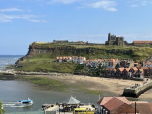
Shipping Forecast fans will know that the North Sea incorporates several shipping areas, including Forties, Tyne, German Bight, Humber, Dogger and the Utsiras among others.
Beneath the waves, the North Sea has an impressive ‘landscape’ with great sand banks including Dogger Bank, Jutland Bank and the Norfolk Banks to name a few.
The North Sea experiences storm surges from time to time with historical records mentioning a storm tide flood in 1164.
A storm tide in 1228 is thought to have killed over 100,000 people.
There was also a North Sea flood in 1953.
In 1931, the Dogger Bank earthquake, which measured 6.1 on the Richter Scale, caused a small tsunami which flooded part of the British coast.
Ghosts in the Harbour
Whitby is well known for its hauntings, and the harbour is no exception.
While there have been numerous sightings, there is a famous story connected with West Pier Lighthouse.
It is said to be haunted by a one-armed male ghost who fell to his death on the rocks beneath the lighthouse.
Sunrise and Sunset
Did you know that Whitby is one of the few places where you can see the sun rise and set over the sea during the summer?
Recent Developments
There are some stunning pieces of artwork around the harbour.
This includes the ornamental gate on the West Pier, along with capstans and mooring posts from the past.
What to do next
If we’ve whetted your appetite with our whistle stop history of Whitby’s harbour, piers and lighthouses, then why not book a stay with us?

